Chapter 3
Models of the Earth
Section 1: Finding Locations on Earth
Key Ideas
Distinguish between latitude and longitude.
Explain how latitude and longitude can be used to locate places on Earth's surface.
Explain how a magnetic compass can be used to find directions on Earth's surface.
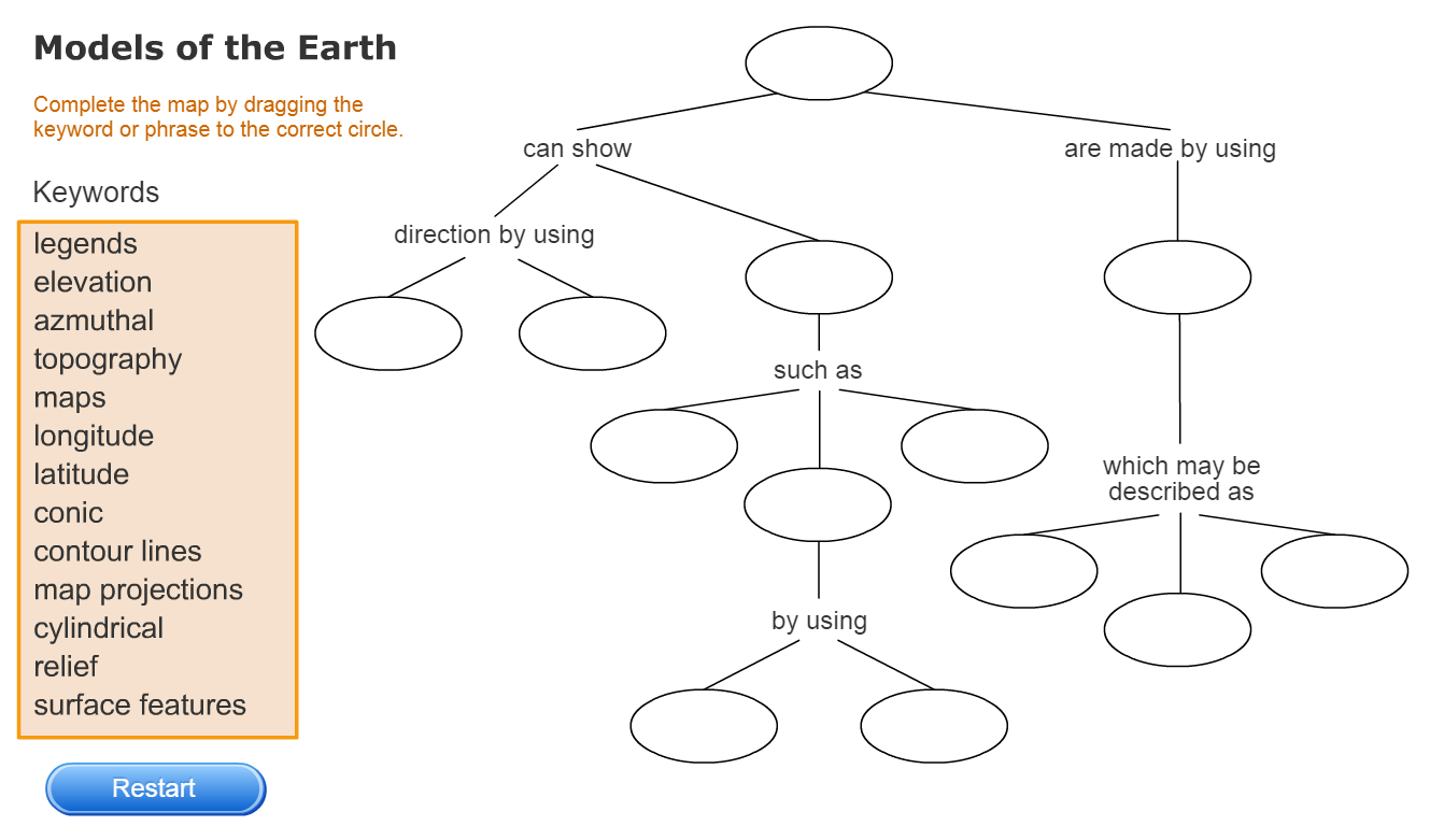
Section 2: Mapping Earth’s Surface
Key Ideas
Explain two ways that scientists get data to make maps.
Describe the characteristics and uses of three types of map projections.
Summarize how to use keys, legends, and scales to read maps.
Section 3: Types of Maps
Key Ideas
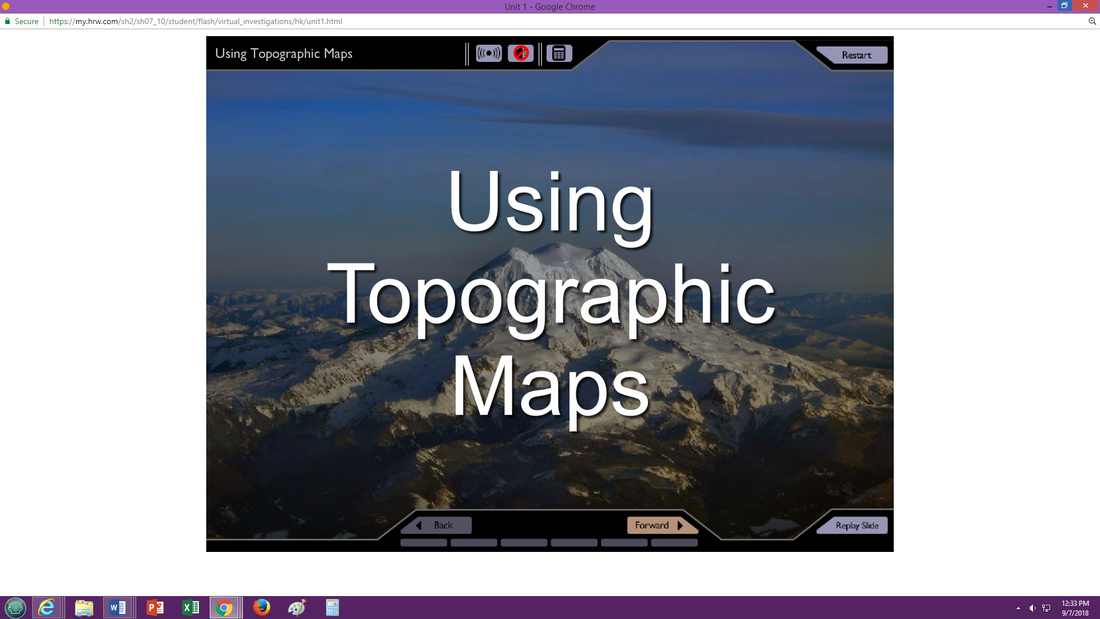
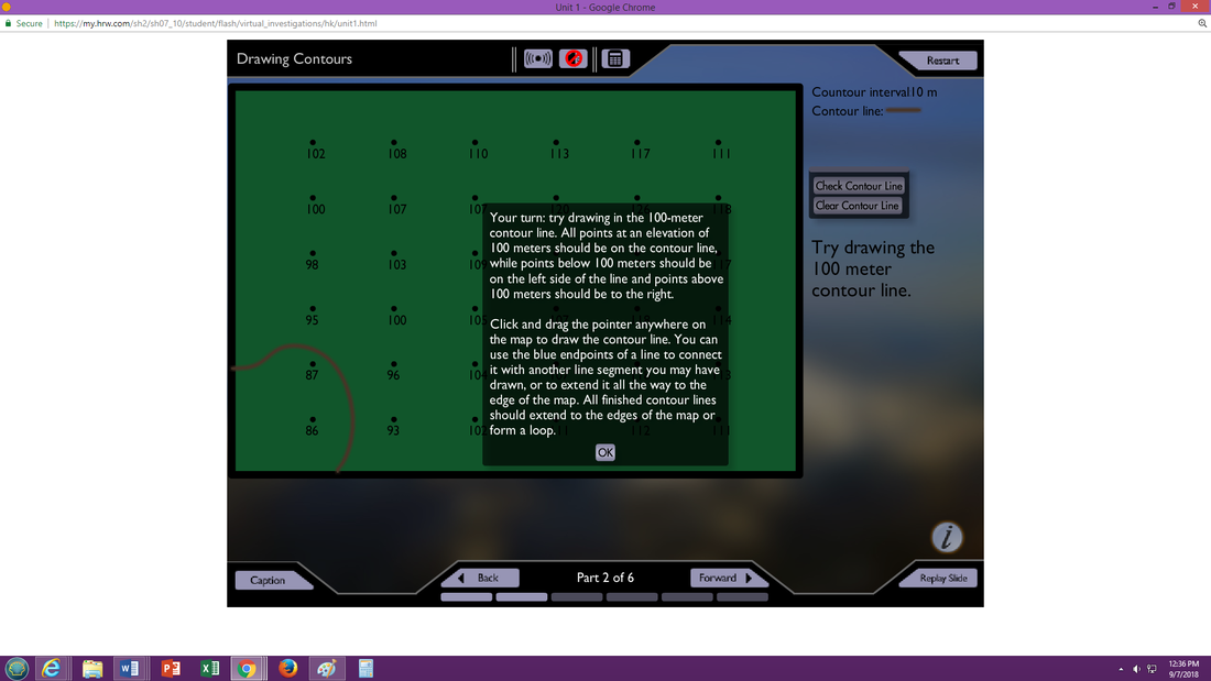
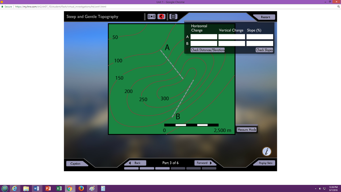
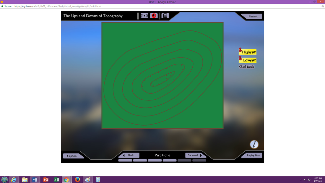
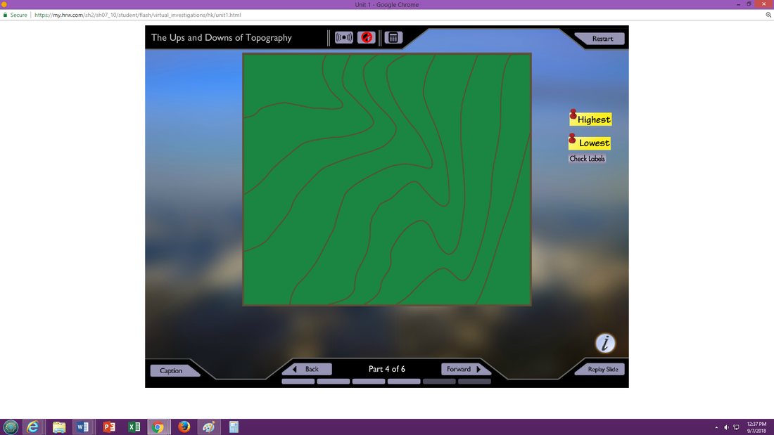
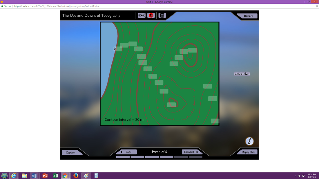
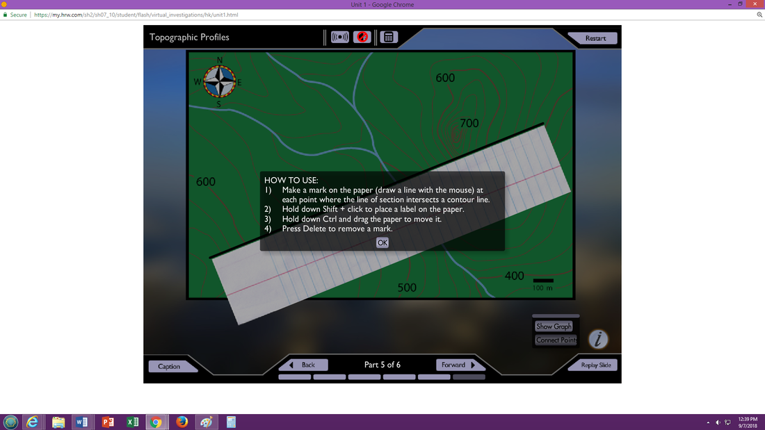
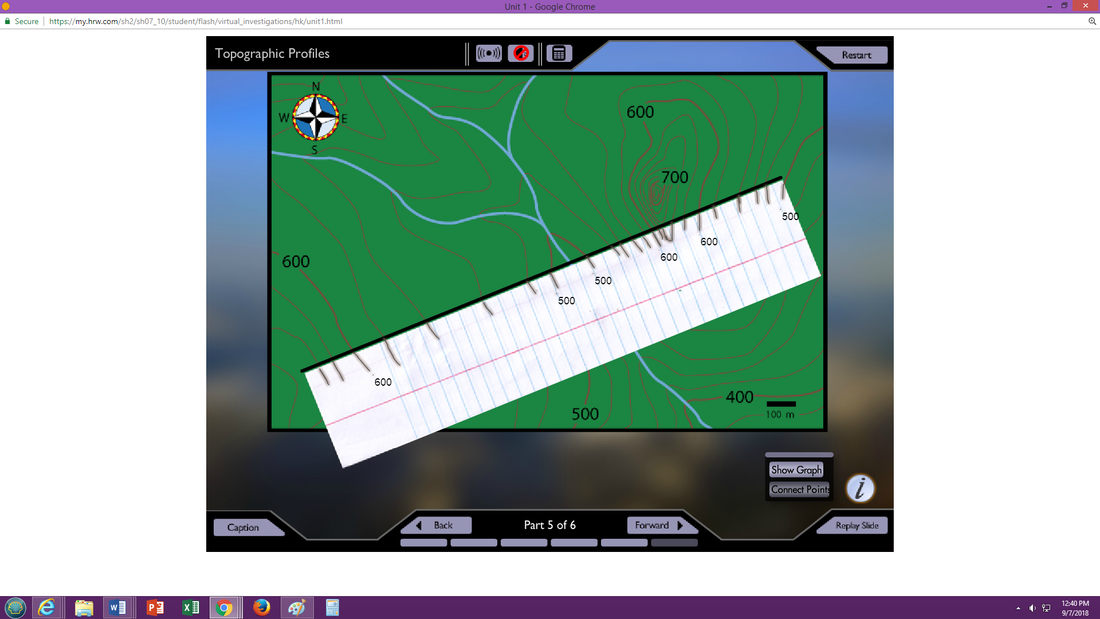
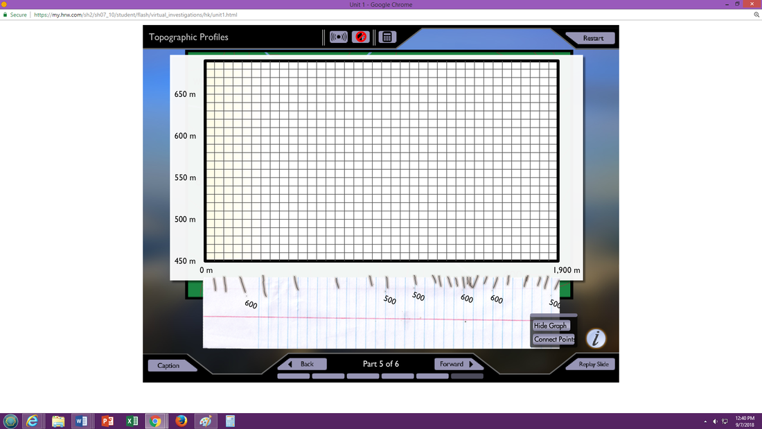
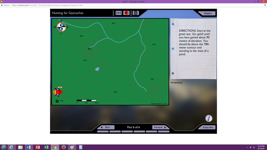
Explain how elevation and topography are shown on a map.
Describe three types of information shown in geologic maps.
Identify two uses of soil maps.
Section 2: Mapping Earth’s Surface
Key Ideas
Explain two ways that scientists get data to make maps.
Describe the characteristics and uses of three types of map projections.
Summarize how to use keys, legends, and scales to read maps.
Section 2: Mapping Earth’s Surface
Key Ideas
Explain two ways that scientists get data to make maps.
Describe the characteristics and uses of three types of map projections.
Summarize how to use keys, legends, and scales to read maps.
| concept_map.png |
| 02.doc |
Click above if you want to download the document.
| 02_latitude_and_longitude_worksheets.pdf |
| topo_map_ws_1.pdf |
| topo_map_ws_2.pdf |
Topographic Map Rules Link
| 03_topographic_map_activity_using_a_map_in_the_textbook.pdf |
| 02_answers.pdf |
| 02_latitude_and_longitude_answers_2.pdf |
